In Florida, June typically marks the beginning of hurricane season. Preparation for a storm may appear as otherworldly as it is routine: businesses and homes board up windows and doors, bottled water is quick to sell out, and public buildings cease operations to serve as emergency shelters.
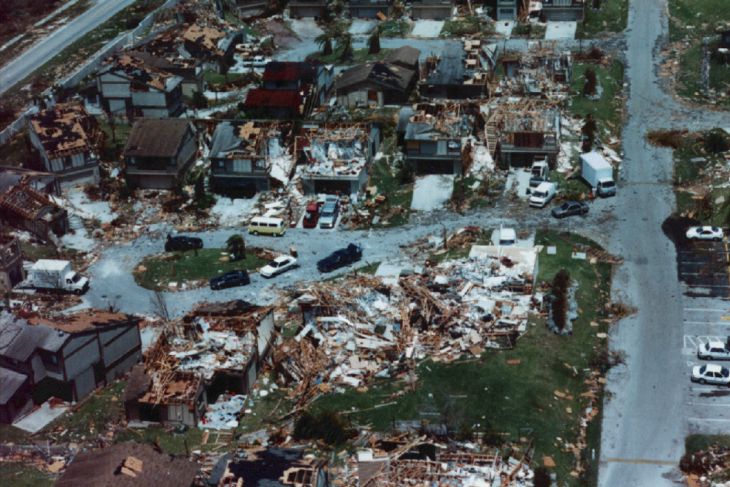
What happens next may be unpredictable. If things take a turn for the worse, myriad homes may be leveled. A 2019 Congressional Budget Office report estimated that hurricane-related wind damage causes $14 billion in losses to the residential sector annually.
However, new research led by Ipek Bensu Manav, an MIT graduate student in civil and environmental engineering and research assistant at MIT’s Concrete Sustainability Hub, suggests that the value of mitigating this wind damage through stronger construction methods may be significantly underestimated.
In fact, the failure of wind loss models to account for neighborhood texture — the density and configuration of surrounding buildings with respect to a building of interest — may result in an over 80 percent undervaluation of these methods in Florida.
Methodology
Hazus, a loss estimation tool developed and currently used by the Federal Emergency Management Agency (FEMA), estimates physical and economic damage to buildings due to wind and windborne debris. However, the tool assumes that all buildings in a neighborhood experience the same wind loading.
Manav notes that this assumption disregards the complexity of neighborhood texture. Buildings of different shapes and sizes can be arranged in innumerable ways. This arrangement can amplify or reduce the wind load on buildings within the neighborhood.
Wind load amplifications and reductions result from effects referred to as tunneling and shielding. Densely built-up areas with grid-like layouts are particularly susceptible to wind tunneling effects. You might have experienced these effects yourself walking down a windy street, such as Main Street in Cambridge, Massachusetts, near the MIT campus, only to turn the corner and feel calmer air.
To address this, Manav and her team sought to create a hurricane loss model that accounts for neighborhood texture. By combining GIS files, census tract data, and models of wind recurrence and structural performance, the researchers constructed a high-resolution estimate of expected wind-related structural losses, as well as the benefits of mitigation to reduce those losses.
The model builds on prior research led by Jacob Roxon, a recent CSHub postdoc and co-author of this paper, who developed an empirical relationship that estimates building-specific wind gusts with information about building layout in a given neighborhood.
A challenge the researchers had to overcome was the fact that the building footprints that were available for this estimation have little-to-no information on occupancy and building type.
Manav addressed this by developing a novel statistical model that assigns occupancy and building types to structures based on characteristics of the census tract in which they are located.
Analysis and cost perspective
The researchers then estimated the value of stronger construction in a case study of residential buildings in Florida. This involved modeling the impact of several mitigation measures applied to over 9.3 million housing units spread across 6.9 million buildings.